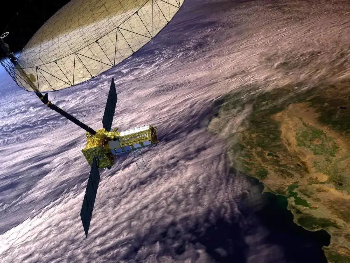
The Indian Space Research Organisation (ISRO) is preparing for an important milestone, launching the NISAR satellite, a collaborative Earth-observation mission with NASA, scheduled for July 30. The launch will take place from the Satish Dhawan Space Centre in Sriharikota, Andhra Pradesh, with ISRO’s GSLV Mk II rocket carrying the payload into orbit.
NISAR, short for NASA-ISRO Synthetic Aperture Radar, is designed to map Earth’s surface with a level of detail that could significantly enhance how we understand environmental changes and manage natural disasters. While it’s a scientific mission at its core, the collaboration itself also speaks volumes about growing global partnerships in space exploration.
Key Takeaways
- What: NASA-ISRO Synthetic Aperture Radar (NISAR) satellite launch
- Who: Joint project between NASA and ISRO
- When: July 30, from Sriharikota, India
- Launch Vehicle: ISRO’s GSLV Mk II
- Mission Goal: A three-year mission to observe and track surface changes across the planet
This project has been in development for nearly a decade, following an agreement between NASA and ISRO signed back in 2014. NASA has contributed the L-band Synthetic Aperture Radar (SAR), along with high-rate communication systems, GPS receivers, and a solid-state data recorder. On the Indian side, ISRO developed the S-band SAR, built the spacecraft, and is managing the launch. Final integration happened in India after NASA’s equipment arrived in March 2023.
What makes NISAR especially powerful is its ability to operate on both L-band and S-band frequencies. That’s a first for any radar satellite. This dual-frequency capability allows it to penetrate cloud cover, smoke, and even work during nighttime, an essential trait for consistent Earth monitoring. The satellite will also carry a 12-meter-wide wire mesh antenna that will unfold in orbit to send and receive radar signals.
The science here isn’t just theoretical. NISAR is expected to scan the entire Earth every 12 days and detect minute changes in the planet’s surface, sometimes just a few millimetres at a time. That level of precision can help forecast earthquakes, monitor volcanoes, and even assess groundwater depletion. For India, specifically, it could be a game-changer in tracking crop health, managing forest cover, and improving flood preparedness during monsoon seasons.
There’s also a sense of national pride in this mission. The fact that a satellite of this scale and importance is launching from Indian soil, aboard an Indian rocket, reflects just how far the country’s space program has come. The GSLV Mk II, which will carry the 2,800 kg satellite, is a trusted workhorse for ISRO, already having several successful missions under its belt.
So while the satellite’s job will be to keep an eye on Earth, the launch itself quietly signals something bigger, a deepening of international collaboration in space, and India’s growing role in it.
Frequently Asked Questions (FAQs)
Q1. What is the full form of NISAR?
A1. NISAR stands for NASA-ISRO Synthetic Aperture Radar.
Q2. Which rocket will launch the NISAR satellite?
A2. ISRO’s Geosynchronous Satellite Launch Vehicle (GSLV) Mark II will launch the NISAR satellite from Sriharikota, India.
Q3. What is the main purpose of the NISAR mission?
A3. The main purpose is to observe Earth’s land and ice surfaces with high resolution to monitor changes related to climate, natural disasters, and ecosystems. It will map the entire planet once every 12 days.
Q4. How much did the NISAR satellite cost?
A4. The total cost of the mission is estimated to be around $1.5 billion, with NASA’s contribution being over $1 billion, making it one of the most expensive Earth-imaging satellites ever built.
Q5. Will the data from NISAR be available to the public?
A5. Yes, NASA and ISRO plan to make the data from the NISAR mission available to the public and scientific community for free and open access to encourage research and application development.


